Site Network: um_bloggers | imagebank | videoworks | business home

Welcome to imagebank.um-gallery.net

Only through art can we emerge from ourselves and know what another person sees.

- Marcel Proust, Maxims


China Scenery 4. 中國景物4

(Max 800x800 pixel)


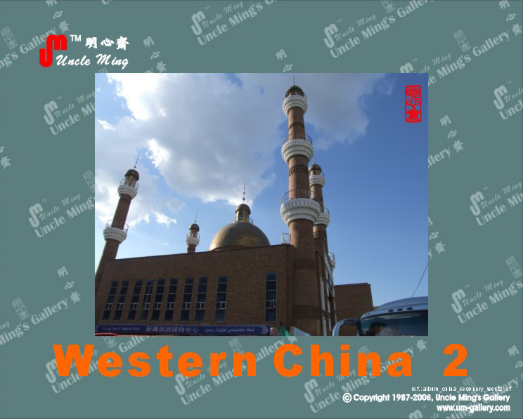
Western China  華西

western china
中國西部泛指中國西部地區。從地理來看,西部指西南、西北地區,不包括廣西壯族自治區和 內蒙古自治區。由於目前西部地區經濟相對落後,隨著西部大開發計劃的提出,概念漸漸明晰。按西部大開計劃概定以及國務院西部地區開發領導小組辦公室協調的 範圍,西部由12個省、直轄市、自治區及3個自治州構成,包括:
中國四大經濟地理區

  • 重慶市
  • 四川省
  • 雲南省
  • 貴州省
  • 陝西省
  • 青海省
  • 甘肅省
  • 寧夏回族自治區
  • 新疆維吾爾族自治區
  • 西藏自治區
  • 廣西壯族自治區
  • 內蒙古自治區
  • 吉林省延邊朝鮮族自治州
  • 湖北省恩施土家族苗族自治州
  • 湖南省湘西土家族苗族自治州

中國西部地形複雜,氣候類型多樣,為不同的植物生長和野生動物棲息創造了良好條件,擁有豐富的生物資源。此外,西部礦產資源、水利資源、旅遊資源、人文資源也極其豐富。
西部12省市區面積約672萬平方公里,佔中國國土面積70%,人口約3.3億,約佔全國總人口的25%,但GDP僅佔中國大陸的13%。如何處理西部問題,已成為中國的最大挑戰之一。
Source: wikipedia

Recommendation 特別推介

2011 Tibet 1 西藏 1

Photograph by S K Wong
tobet 2011


2011 Tibet 2 西藏 2

Photograph by E S F Wong
tobet 2011
The Tibet Autonomous Region (TAR), Tibet or Xizang for short, also called the Xizang Autonomous Region (Chinese: 西藏自治区) is a province-level autonomous region of the People's Republic of China (PRC). It was created in 1965 on the basis of an administrative region which had been incorporated into the PRC in 1951.
Within the People's Republic of China, Tibet is identified with the Autonomous Region, which includes about half of ethno-cultural Tibet, including the traditional provinces of Ü-Tsang and the western half of Kham. The borders of the present Autonomous Region coincide roughly with the actual zone of control of the then-government of Tibet in 1950. The Tibet Autonomous Region is the second-largest province-level division of China by area, spanning over 1,200,000 square kilometres (460,000 sq mi), after Xinjiang, and due to its generally harsh terrain, is the least densely populated provincial-level division of the PRC.
The Tibet Autonomous Region is located on the Tibetan Plateau, the highest region on earth. In northern Tibet elevations reach an average of over 4,572 metres (15,000 ft). Mount Everest is located on Tibet's border with Nepal.
The Chinese provincial-level areas of Xinjiang, Qinghai and Sichuan lie to the north, northeast, and east, respectively, of the Tibet AR. There is also a short border with Yunnan province to the southeast. The PRC has border disputes with the Republic of India over the McMahon Line of Arunachal Pradesh, known to the Chinese as "South Tibet". The disputed territory of Aksai Chin is to the west, and its boundary with that region is not defined. The other countries to the south are Myanmar, Bhutan and Nepal.
Physically, the Tibet AR may be divided into two parts, the "lakes region" in the west and north-west, and the "river region", which spreads out on three sides of the former on the east, south, and west. Both regions receive limited amounts of rainfall as they lie in the rain shadow of the Himalayas, however the region names are useful in contrasting their hydrological structures, and also in contrasting their different cultural uses which is nomadic in the lake region and agricultural in the river region.[8] On the south the Tibet AR is bounded by the Himalayas, and on the north by a broad mountain system. The system at no point narrows to a single range; generally there are three or four across its breadth. As a whole the system forms the watershed between rivers flowing to the Indian Ocean – the Indus, Brahmaputra and Salween and its tributaries – and the streams flowing into the undrained salt lakes to the north.
The lake region extends from the Pangong Tso Lake in Ladakh, Lake Rakshastal, Yamdrok Lake and Lake Manasarovar near the source of the Indus River, to the sources of the Salween, the Mekong and the Yangtze. Other lakes include Dagze Co, Nam Co, and Pagsum Co. The lake region is an arid and wind-swept desert. This region is called the Chang Tang (Byang sang) or 'Northern Plateau' by the people of Tibet. It is some 1100 km (700 mi) broad, and covers an area about equal to that of France. Due to its great distance from the ocean it is extremely arid and possesses no river outlet. The mountain ranges are spread out, rounded, disconnected, separated by flat valleys relatively of little depth.
The Tibet AR is dotted over with large and small lakes, generally salt or alkaline, and intersected by streams. Due to the presence of discontinuous permafrost over the Chang Tang, the soil is boggy and covered with tussocks of grass, thus resembling the Siberian tundra. Salt and fresh-water lakes are intermingled. The lakes are generally without outlet, or have only a small effluent. The deposits consist of soda, potash, borax and common salt. The lake region is noted for a vast number of hot springs, which are widely distributed between the Himalaya and 34° N., but are most numerous to the west of Tengri Nor (north-west of Lhasa). So intense is the cold in this part of Tibet that these springs are sometimes represented by columns of ice, the nearly boiling water having frozen in the act of ejection.
The river region is characterised by fertile mountain valleys and includes the Yarlung Tsangpo River (the upper courses of the Brahmaputra) and its major tributary, the Nyang River, the Salween, the Yangtze, the Mekong, and the Yellow River. The Yarlung Tsangpo Canyon, formed by a horseshoe bend in the river where it flows around Namcha Barwa, is the deepest, and possibly longest canyon in the world.[9] Among the mountains there are many narrow valleys. The valleys of Lhasa, Shigatse, Gyantse and the Brahmaputra are free from permafrost, covered with good soil and groves of trees, well irrigated, and richly cultivated.
The South Tibet Valley is formed by the Yarlung Zangbo River during its middle reaches, where it travels from west to east. The valley is approximately 1200 kilometres long and 300 kilometres wide. The valley descends from 4500 metres above sea level to 2800 metres. The mountains on either side of the valley are usually around 5000 metres high.[10][11] Lakes here include Lake Paiku and Lake Puma Yumco.

西藏自治區,藏語拼音:Poi Ranggyong Jong),簡稱藏,通稱西藏,為中華人民共和國西南邊疆的一個自治區(省級行政單位),自治區位於青藏高原上,首府是拉薩市。
久遠之前,大洋漸消,高原出露,洋中孽畜,
五頭毒龍,凶性大發,翻掀巨浪,生靈荼毒。
五位仙女,從天而降,法力齊施,鎮壓惡龍。
為保久安,仙女化峰,其第三者,珠穆朗瑪。

以上為西藏的史詩傳說,描述的是世界第一高峰「聖母峰」之由來。與藏族先祖的傳說相對照下,距今兩億年前,本區原為一片汪洋大海,兩千多萬年前始在古喜馬 拉雅山造山運動中大幅崛起,形成今日的高原地貌。西藏為青藏高原的一部份;青藏高原,面積約250萬平方公里,佔中國總面積的四分之一,平均高度在海拔 4000公尺以上,是全球最高最大的高原,素有「世界屋脊」之稱。
高原上,日溫差甚大,所謂「一年無四季,一日見四季」正是形容年日溫差變化最佳的寫照。西藏高原地區遼闊,擁有豐富的能源,其中尤以太陽能、水力、地熱三 者為最。西藏太陽能為全中國最豐富之地區。拉薩,即因年日照數在3000小時以上,而有「日光城」之稱。高原之上,亦為中國各大河流之發源地,如長江、黃 河、雅魯藏布江、瀾滄江、怒江等,水力蘊藏量為中國第一。

(Source: wikipedia)

2010 Guizhou 貴州

dragon palace

Guizhou is the home of the Maotai Distillery, distillers of Maotai liquor, China's most famous alcoholic beverage. The Chinese name of the distillery is Zhongguo Guizhou Maotai Jiuchang. Guizhou is famous among chinese for an old chinese proverb-"The Guizhou donkey is at his wit's end". In reality, Guizhou was a remote area far away from the center of the ancient chinese civilization. However, a lot of archeological deiscoveries show that this autonomous county was populated since the neo-lithic age. It came under Chinese control during the Han Dynasty and well known by the Chinese for thousands of years but it was not until the Ming dynasty that it came under heavy Chinese settlement and domination during which it was made a province. This prompted mass migration from Sichuan, Hunan and its surrounding provinces into Guizhou.
貴州以茅台酒及成語「黔驢技窮」馳名於世。
貴州是古人類發祥地之一,遠古人類化石和遠古文化遺存發現頗多。據考古,中國南方主要的舊石器時代文化遺址,多在貴州境內發現的。
貴州建省雖然只有500多年,但是貴州的歷史可以追溯得更遠。
春 秋時期,當時在今貴州境內有牂牁(普通話音zāng kē)古國,並與中原有交往。戰國時屬於楚國的黔中郡,地域面積在今貴州沿河到榕江以東,包括銅仁地區和黔東南部分縣。秦始皇統一中國後,貴州分屬巴郡、 蜀郡、黔中郡和象郡管轄。漢武帝時設置了牂牁郡,管轄當時貴州的大部分地區。唐朝曾在此設黔中道,建黔州郡,設黔州都督府。
「貴州」名稱,始於宋朝。公元974年,土著首領普貴以控制的矩州歸順,宋朝在敕書中有:「惟爾貴州,遠在要荒」一語,這是以貴州之名稱此地區的最早記載。明朝永樂十一年(公元1413年)設置貴州承宣布政使,正式建製為省,以貴州為省名。
貴州的歷史總離不開一個「黔」字,代代相同,直至貴州建省。這就是貴州簡稱「黔」的由來。

Information Source: wikipedia
15/4/2010

2009 Marvelous Natural Scenery in Southwest China

 2009中國西南自然奇觀

yaumatei 2009 revisit

The scenery here is parallel to the great canyon in America. Thousands of photos organized in two albums were taken for recording the great work of nature. 媲美美國大狹谷的自然奇景, 令人驚嘆大自然的鬼斧神工, 不覺間攝下上千張照片


Guizhou is the home of the Maotai Distillery, distillers of Maotai liquor, China's most famous alcoholic beverage. The Chinese name of the distillery is Zhongguo Guizhou Maotai Jiuchang. Guizhou is famous among chinese for an old chinese proverb-"The Guizhou donkey is at his wit's end". In reality, Guizhou was a remote area far away from the center of the ancient chinese civilization.....

Yunnan-2, 2009 
雲南-2, 2009yunnan 2009

The scenery here is parallel to the great canyon in America. Thousands of photos organized in two albums were taken for recording the great work of nature. 媲美美國大狹谷的自然奇景, 令人驚嘆大自然的鬼斧神工, 不覺間攝下上千張照片

Yunnan-1, 2009 
雲南-1, 2009yunnan-1  2009

雲南是中國最西南方的一個省份,北回歸線穿過省境南部,全省面積為394,000平方千米,佔全國4.1%。該省的東面是廣西壯族自治區和貴州省,北面是 四川省,西北面是西藏自治區。雲南的國境線長4,060千米,與3個國家接壤:西面是緬甸(主要口岸是瑞麗),南面是寮國(主要口岸是磨憨),東南方是越 南(主要口岸是河口-老街)。

(source: wikipedia)

Yunnan 2007  雲南2007yunnan

公元前3世紀,楚國大將莊蹻進入滇池地區,建立滇國。前221年,秦始皇統一六國,在雲南東北部設立郡縣,並開五尺道自今曲靖聯繫內地。前109年,漢武 帝派將軍郭昌入滇征服西南夷,設立益州郡和24個縣,郡治滇池縣(今晉寧),開闢通往緬甸和印度的商道,又派唐蒙修復擴建五尺道,更名為「西南夷道」。漢 朝征服西南夷時,發現當地有來自「身毒」的商人(今日巴基斯坦信德省在梵語中稱為「Sindhu」。三國時期,雲南地區稱為「南中」,225年, 蜀國丞相諸葛亮率大軍降服「南中」大王孟獲。
雲南省目前下轄16個地級行政單位,包括8個地級市、8個自治州;以及129個縣級行政單位,包括12個市轄區、9個縣級市、79個縣、29個自治縣。

(source: wikipedia)

south frontier 南疆south frontier

南疆即新疆的南部,包括塔里木盆地、昆仑山 脉新疆部分以及吐鲁番盆地,自古以来就是一个多民族聚居的地区,维吾尔、塔吉克等民族的艺术和风情绚丽多彩,构成了具有浓郁民族特色的人文景观。在古丝绸 之路的南、中两条干线上留下的数以百计的古城池、古墓葬、千佛洞等古迹昭示着历史的悠久与沧桑。
(source: baidu.com)

Tibet 西藏tibet

久遠之前,大洋漸消,高原出露,洋中孽畜,
五頭毒龍,凶性大發,翻掀巨浪,生靈荼毒。
五位仙女,從天而降,法力齊施,鎮壓惡龍。
為保久安,仙女化峰,其第三者,珠穆朗瑪。

以上為西藏的史詩傳說,描述的是世界第一高峰「聖母峰」之由來。

dengwang  敦煌dengwang

敦煌,古代又稱燉煌,是甘肅省酒泉市轄的一個縣級市,中國的國家歷史文化名城,歷來為絲綢之路上的重鎮。以「敦煌石窟」、「敦煌壁畫」聞名天下,是世界遺產莫高窟和漢長城邊陲玉門關、陽關的所在地。
Dunhuang (敦煌 )is a city (pop. 187,578 (2000)) in northwestern Gansu province, Western China. It was a major stop on the ancient Silk Road. It was also known at times as Shāzhōu (沙州), or 'City of Sands', a name still used today, "or Dukhan as the Turkis call it." It is best known for the nearby Dunhuang Caves.
It is situated in a rich oasis containing Crescent Lake (月牙泉) and Mingsha Shan (鸣沙山, literally "Echoing-Sand Mountain"). Mingsha Shan is so named for the sound of the wind whipping off the dunes, the singing sand phenomenon.
It commands a very strategic position at the crossroads of the ancient Southern Silk Route and the main road leading from India via Lhasa to Mongolia and Southern Siberia, as well as controlling the entrance to the narrow Gansu Corridor which led straight to the heart of the north Chinese plains and the ancient capitals of Chang'an (today known as Xi'an) and Luoyang.
(source: wikipedia)

silkroad 絲路silk road

The Silk Road or Silk Route refers to a historical network of interlinking trade routes across the Afro-Eurasian landmass that connected East, South, and Western Asia with the Mediterranean and European world, as well as parts of North and East Africa. The land routes were supplemented by sea routes which extended from the Red Sea to East Africa, India, China, and Southeast Asia.
Extending 4,000 miles (6,500 km), the Silk Road gets its name from the lucrative Chinese silk trade along it, which began during the Han Dynasty (206 BCE – 220 CE). The central Asian sections of the trade routes were expanded around 114 BCE by the Han dynasty, largely through the missions and explorations of Zhang Qian, but earlier trade routes across the continents already existed.[citation needed] In the late Middle Ages, transcontinental trade over the land routes of the Silk Road declined as sea trade increased,. In recent years, both the maritime and overland Silk Routes are again being used, often closely following the ancient routes.
絲綢之路,常簡稱為絲路,此詞最早來自於德國地理學家費迪南·馮·李希霍芬(Ferdinand von Richthofen)1877年出版的《中國——我的旅行成果》(China, Ergebnisse eigener Reisen)。
絲綢之路通常是指歐亞北部的商路,與南方的茶馬古道形成對比,西漢時張騫和東漢時班超出使西域開闢的以長安(今西安)、洛陽為起點,經甘肅、新疆,到中 亞、西亞,並聯結地中海各國的陸上通道。這條道路也被稱為「陸路絲綢之路」,以區別日後另外兩條冠以「絲綢之路」名稱的交通路線。因為由這條路西運的貨物 中以絲綢製品的影響最大,故得此名。其基本走向定於兩漢時期,包括南道、中道、北道三條路線。
(source: wikipedia)


Arts without Boundary

Almost forty thousands of original photos or images created by our colleagues are now released to the pubic free of charge under our "UM Free Image License". These are only part of our portfolio but it does take us a lot of time to convert the conventional film to digital format. We've  estimated that more than ten thousand images are kept in our studio and we believe they are not just  some kind of artwork but may serve as documentation of the development of our world in the last 40 years. Just click and view.
們已把為數達四萬多張自有原創圖片以 "UM Free Image License" 自由圖像授權協定方式發佈, 我們將繼續把庫存軟片圖庫數碼化, 並增添新作以回饋公眾.